
In partnership with

NavLive is an Oxford University spin-out (est. 2022), headquartered in London, delivering AI-powered LiDAR scan-to-plan technology for AEC professionals.
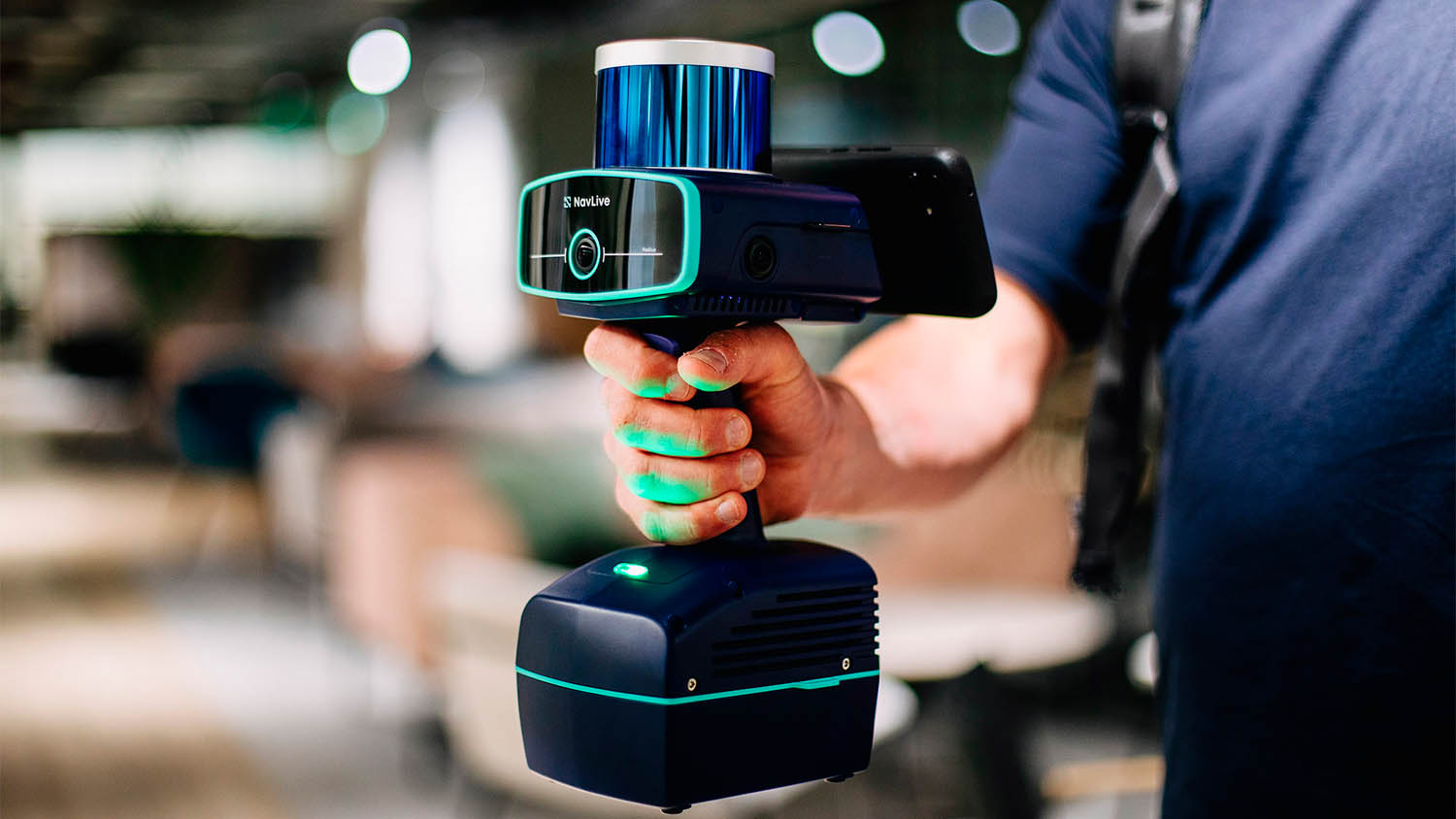
NavLive combines a handheld LiDAR scanner with onboard AI and cloud infrastructure. The device instantly generates RICS-grade (1:100) 2D floor plans, elevations, sections, 3D point clouds, and high-definition images, compatible with Revit, AutoCAD, Archicad, SketchUp, etc. – all through a compact, tripod-free scanning method.
As users move through a space, the scanner builds detailed spatial data and automatically recognises building features (walls, doors, windows. The scan uploads to the NavLive Portal, where teams can review, measure, annotate, and export results in standard formats like DWG, DXF, PDF, E57, LAS.
The NavLive scanner integrates five sensors, including three cameras, LiDAR, and an IMU, all streaming data simultaneously to support simultaneous localisation and mapping (SLAM) and computer vision tasks on site. Previous generations required separate microcontrollers for each sensor, but the latest version which features the Nvidia Jetson Orin system-on-module with integrated CPU, GPU, and dedicated deep learning accelerators, all processing is consolidated into a single platform.
The AI Spotlight Directory is published by AEC Magazine in partnership with HP and Nvidia.